One of the points of emphasis of this Substack column and my “From Poverty to Progress” book series is the importance of geography in human history. Some regions are blessed with geography that promotes economic development, while others suffer from the lack of suitable geography.
Industrial technologies have dramatically lowered geographical barriers to material progress, but societies have great difficulty in escaping from their past.
In previous articles, I wrote about the importance of rivers in promoting material progress. In this article, I shift the focus to river basins. Essentially, the causality works like this:
The topography of a region funnels rainfall downwards toward rivers.
The larger the area of the basin and the greater the annual precipitation, the larger the river.
The confluence and endpoints of navigable waters become likely sites for prosperous trade-based cities (one of the Five Keys to Progress), assuming that:
the river is navigable year-round for long distances
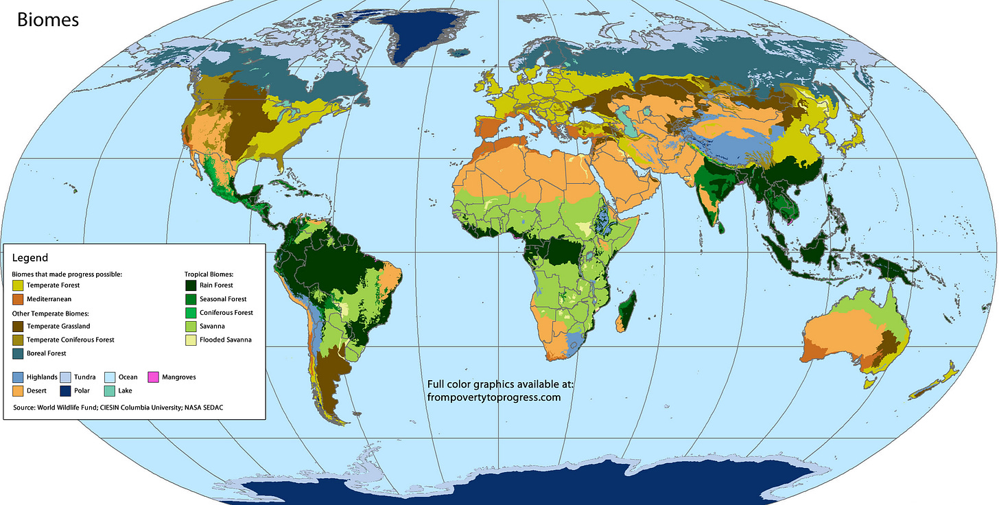
the biome and soil type in the valley is appropriate for intensive farming (another of the Five Keys to Progress)
the growing season is long enough
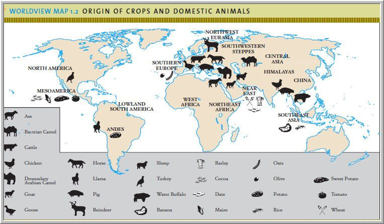
the region has domesticated staple crops and animals that can pull plows.
Now, rivers are not the only possible location for trade-based cities. Many are located on natural ocean ports, which offer many of the same advantages as river ports. But throughout history, the confluence and endpoints of rivers have been the location of most major trade-based cities.
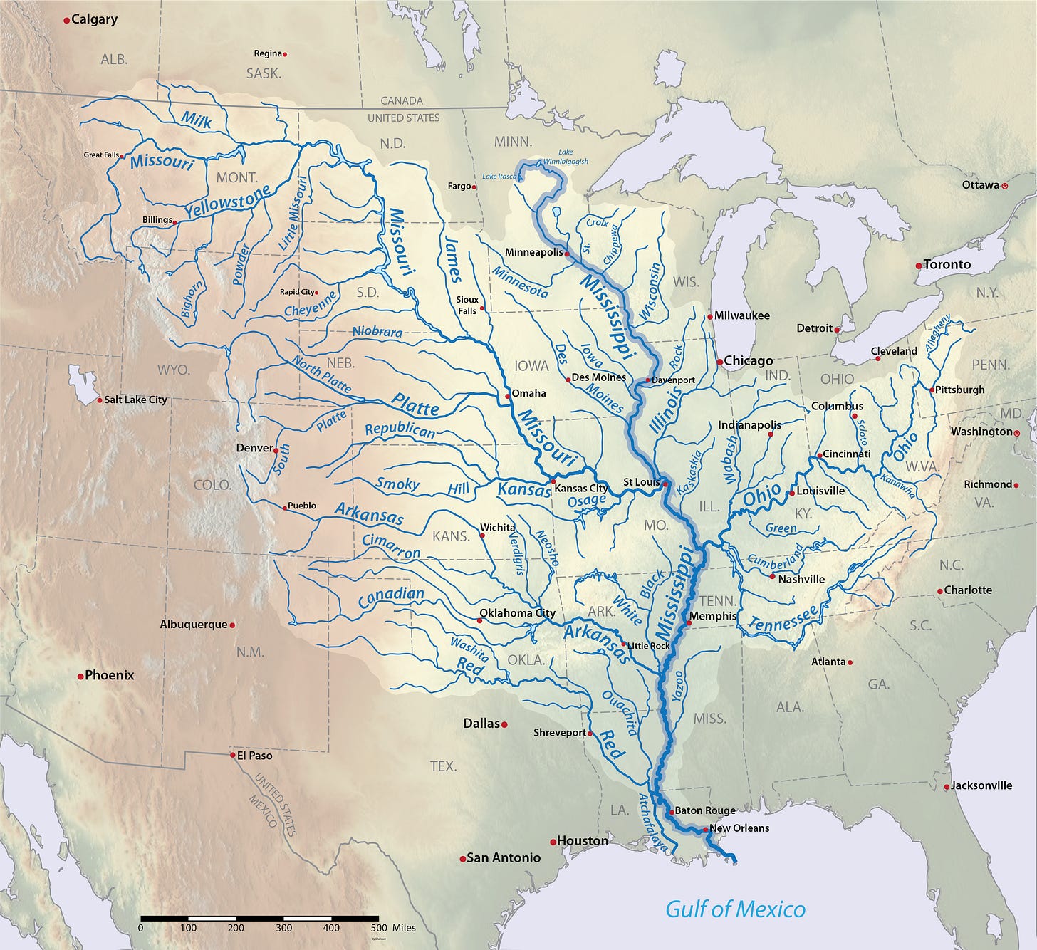
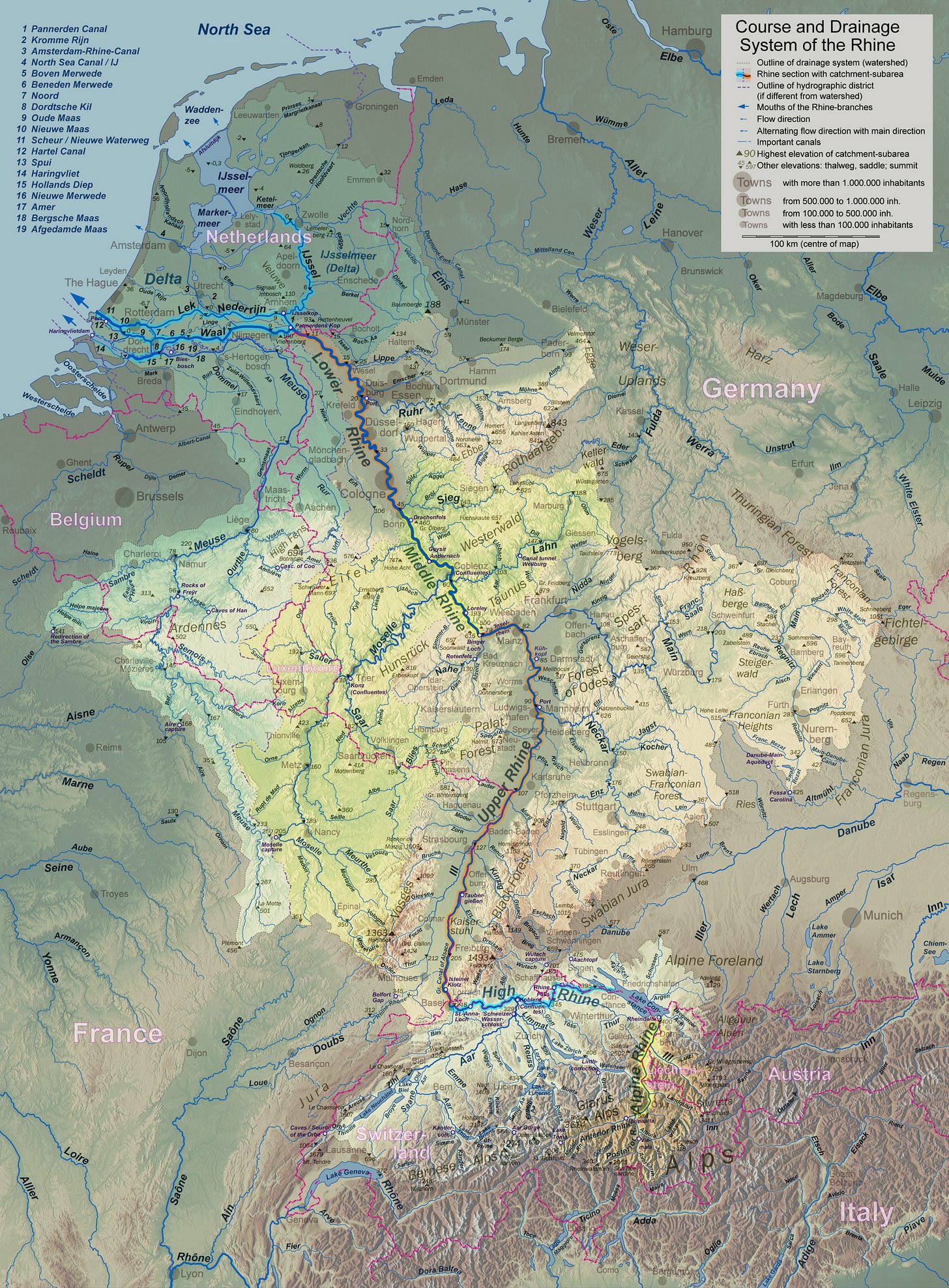
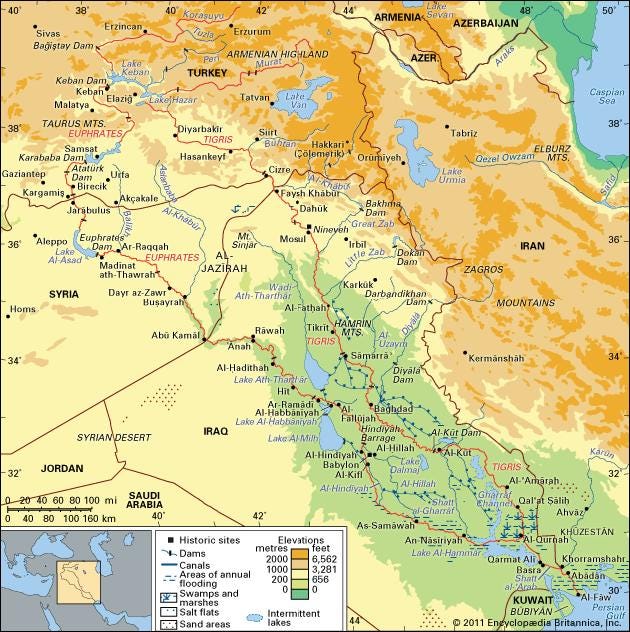
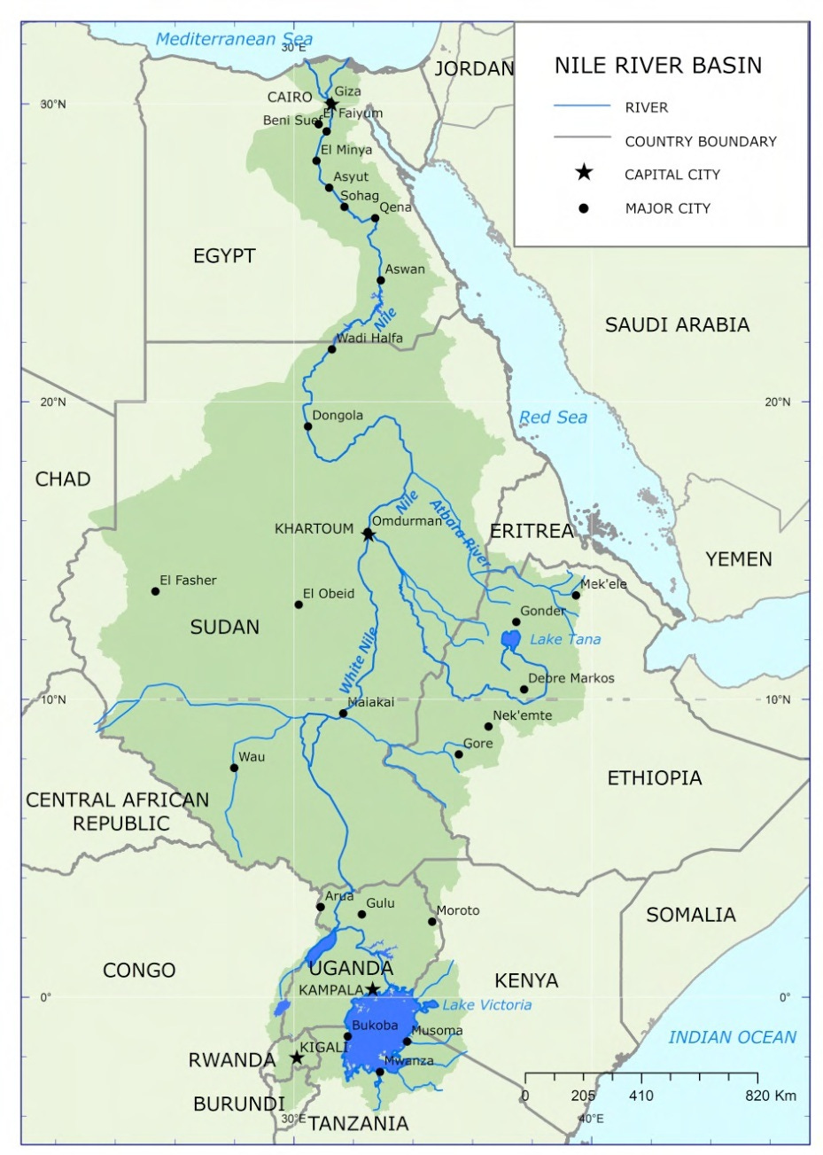
Below are a few maps displaying the critical variables that enable river basins to evolve into prosperous human societies:
If you are interested in this topic, you should read my “From Poverty to Progress” book series:
See more articles on the impact of Geography in human history:
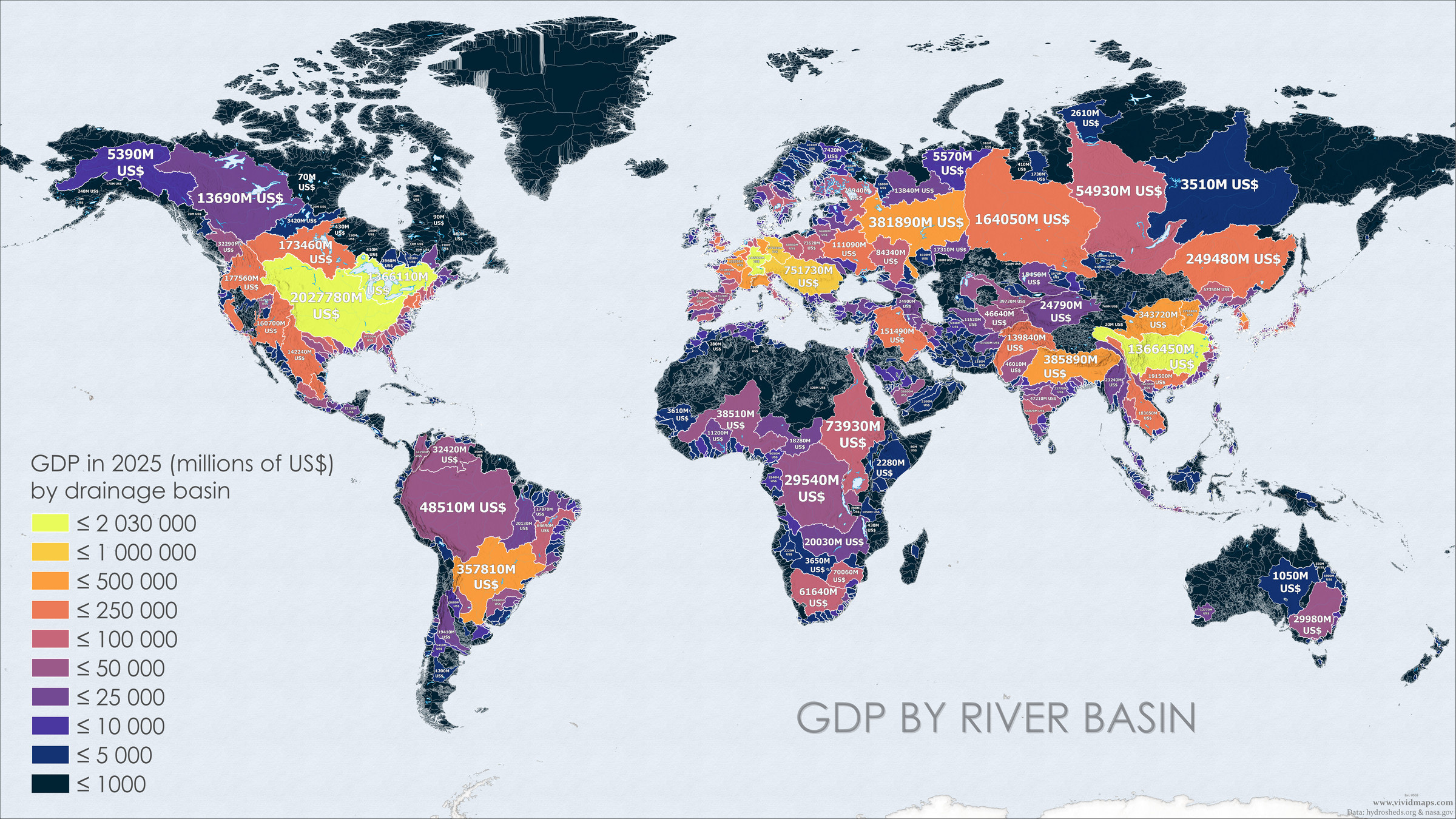
Take a look at the map at the top of this article. It was created by a great website: Vivid Maps. If you are at all interested in geography, I would recommend poking around that website. You are guaranteed to find an interesting map.
The map at the top of this article shows the GDP of river basins. Now I do not claim that river basins are the only factor that matters, but it is pretty obvious from a quick inspection of this map that they have had a big impact on material progress.
First, you can clearly see that a substantial portion of this map is lacking in major river basins (black on this map). Many of these areas have few prospects for long-term economic growth even with the input of modern technology and capital.
In this map, you can also clearly see the economic importance of the:
Mississippi-Missouri-Ohio river basin and the
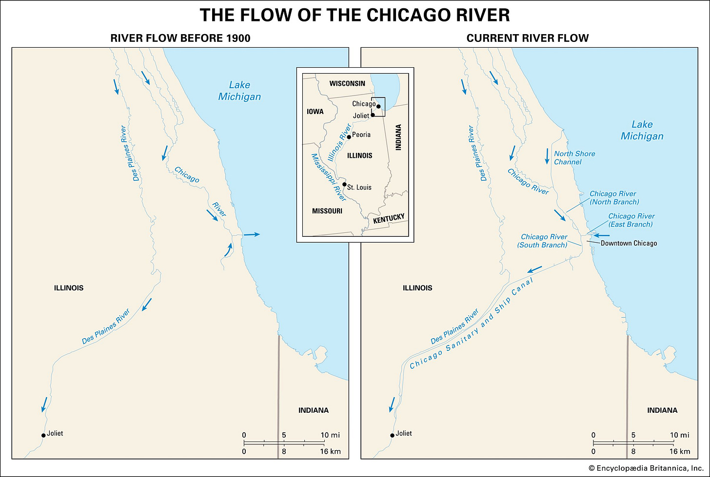
adjoining St. Lawrence-Great Lakes waterway in USA and Canada (which almost connects to the Mississippi basin at Chicago)
Yangtze river basin in China
Greater Rhine basin (including the Meuse and Scheldt rivers) in Germany, Netherlands and Belgium
Together these river basins make up a substantial portion of the world’s economy. You can also clearly see some less wealthy river basins, including the:
Parana river basin that extends to Argentina, Uruguay, Paraguay and parts of southern Brazil.
Yellow river basin in China
Volga river basin in Russia
Ganges-Brahmaputra-Meghina river basin in South Asia

Northwest Europe is unique in that it is a prosperous region that is broken up into many smaller river basins. It seems plausible that this geography is a major cause for why that region has a decentralization of political power (another of the Five Keys to Progress) since the collapse of the Western Roman Empire.
Among the smaller river basins in Northwest Europe that became politically significant are the:
Thames river basin in England
Seines river basin in France
Po river basin in Northern Italy
Elbe river in Germany
Danube river basin in Central Europe and the Balkans.

You can see a similar phenomenon with the Northeast United States. Perhaps this geography also enabled the United States to have relatively decentralized political and economic history throughout most of its history. Indeed the early history of the United States and British North America is almost exclusively about four river basins:
Several other river basins have played important roles in birthing powerful Agrarian societies, but those societies have had difficulty evolving into prosperous modern societies, including the:
Tigrus-Euphrates river basin
Nile river basin
Indus river basin in modern-day Pakistan
Plus many river basins in Southeast Asia that originate in the Tibetan plateau.
And finally we have very large river basins that have never been sites of material progress:
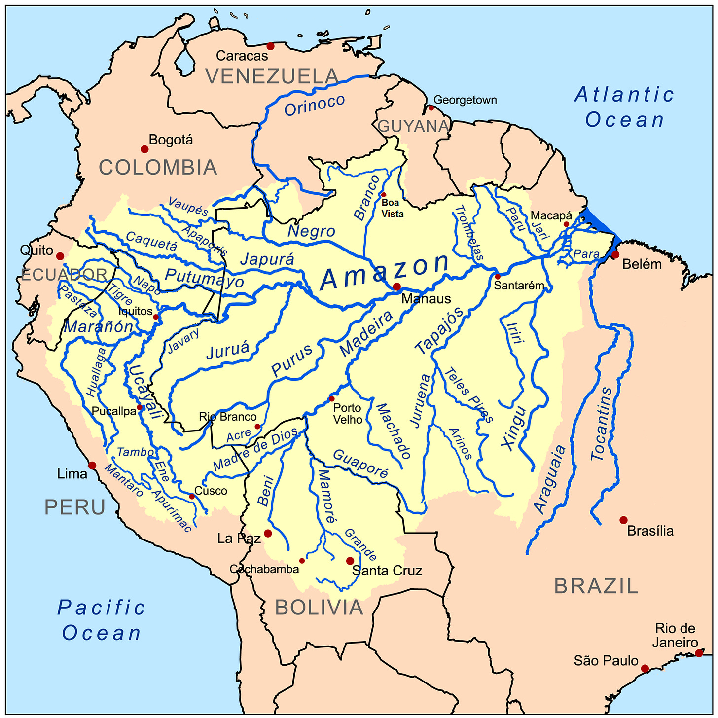
Amazon river basin
Congo river basin.
Of course, this map of river basins does not explain all the wealthy nations in the world today. There are also a significant number of wealthy societies that completely lack major river basins, including Scandinavia, Japan, South Korea, Taiwan, and Singapore. Each of these nations has prosperous trade-based cities located on natural ocean ports.
And some river basins are at least somewhat prosperous because they are part of larger nation that got rich in other river basins and then exploited its natural resources without growing large cities. This is particularly true of Russia.
Let me end this article with a shout-out to another Substacker who writes very interesting articles on the impact of geography on economic development:
. If you read this far, you should subscribe to his great Substack column now!If you are interested in this topic, you should read my “From Poverty to Progress” book series:
See more articles on the impact of Geography in human history:
Some other great Substack columns on geography that you should subscribe to:













What an interesting article! I learned a few new things 🌸
> And finally we have very large river basins that have never been sites of material progress:
> Amazon river basin
Well there has been recent evidence of a lost Amazonian civilization.
https://www.smithsonianmag.com/science-nature/lost-cities-of-the-amazon-discovered-from-the-air-180980142/